Table of Contents
- Why did residents launch this website?
- I am impacted by the quarry. What can I do?
- Where is the quarry located?
- What does the quarry provide?
- Who owns the land? Boral?
- Hasn’t the quarry been there forever?
- How have things changed since quarrying commenced?
- How long will the quarry operate for?
- Why are locals complaining now, not years ago?
- What about the public notification process?
- How was the extension approved?
- Does that mean the entire property can be quarried?
- Where did residents get their information?
- What are residents’ main concerns?
- NIMBY’s eh? If not Redlynch, then where?
- What does Cairns Regional Council say?
- What about other government agencies?
- What role does World Heritage play?
Why did residents launch this website?
This is not a decision we have taken lightly. Residents feel a deep sense of loss, and in some cases trauma. Some are selling up and leaving. This website gives us a voice.
We feel that the quarry’s needs have been unfairly prioritised over those of the community, and that we have been failed by all three levels of government. We consistently hear that once a development has been approved it is hard to roll back. This helplessness compounds the toll.
I am impacted by the quarry. What can I do?
To stay up to date with the latest news, please drop up a note, or join our facebook group. If you are affected by noise, dust, or other operational issues, consider raising a complaint with the following parties.
- Boral, community@boral.com.au
- Cairns Regional Council
- Department of the Environment, Tourism, Science and Innovation
- Queensland Ombudsman
To raise concerns about the extension, contact Ms Bree James, State Member for Barron River.
Where is the quarry located?
626 Redlynch Intake Road, Redlynch QLD 4870. This is approximately eight kilometres west of the Cairns CBD in Queensland, Australia.
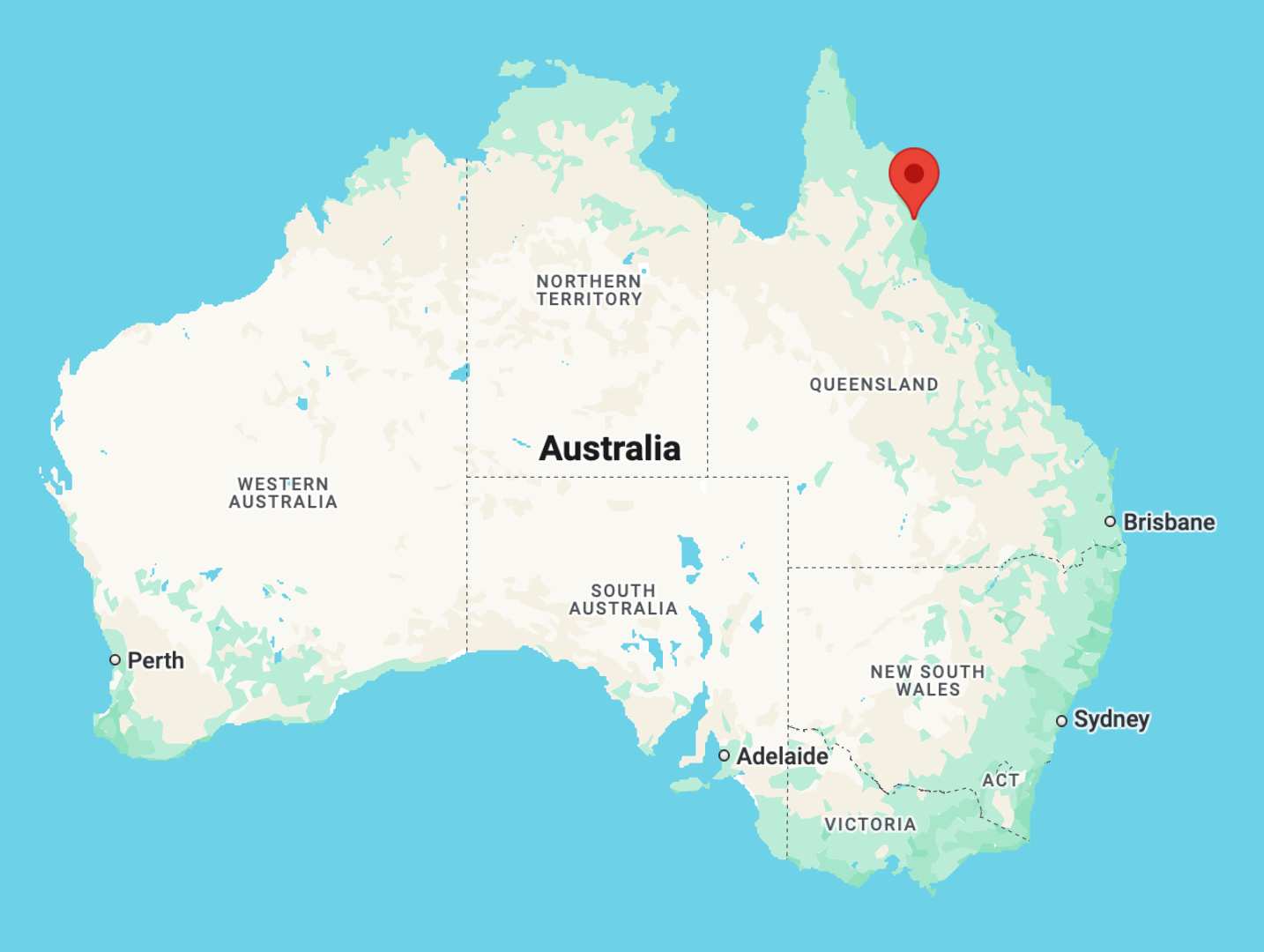 Boral Quarry, Redlynch, Queensland
There are two lots of land, formally described as Lots 8 & 9, RP749301.
What does the quarry provide?
The natural resource is granite and meta-greywacke. These are used in important building and construction materials such as concrete aggregates, armour rock and road base.
Who owns the land? Boral?
The land is owned by three Cairns property developers via the holding companies Crozon Pty Ltd and Hinderwell Pty Ltd. The developers are Frank Gasparin, Ross Straguszi and Peter Hopkins. Frank Gasparin is the majority owner and Gasparin Group advises that the land is under an enviable 50-year lease to Boral.
Hasn’t the quarry been there forever?
A sand quarry operated on the flat areas in the 1980’s. The hard-rock quarry commenced operation in the foothills in 1990.
In 2024 the hard-rock quarry jumped to the top of a mountain ridge.
How have things changed since quarrying commenced?
Since 1990 the environmental and community context has changed dramatically and there have been significant changes in legislation.
| There has been 35 years of planned urban expansion |
|---|
|
| Cassowaries are making a precarious comeback |
|
| Scientists have discovered that silica dust is deadly to humans |
|
| Legislation has changed dramatically in favour of community and environment |
|
How long will the quarry operate for?
It depends. The Council approval is currently through to 2036 but the mountain ridge is commonly cited as having more than 50 years of reserves. Majority owner Gasparin Group claims it has a life of 100 years and is currently under lease to Boral for 50 years.
Why are locals complaining now, not years ago?
The hard-rock quarry has operated for 35 years with only limited complaints. It was mostly in the foothills. A mountain ridge stood between the quarry and its nearest neighbours, protecting those neighbours from the harmful effects of hard-rock extraction and processing.
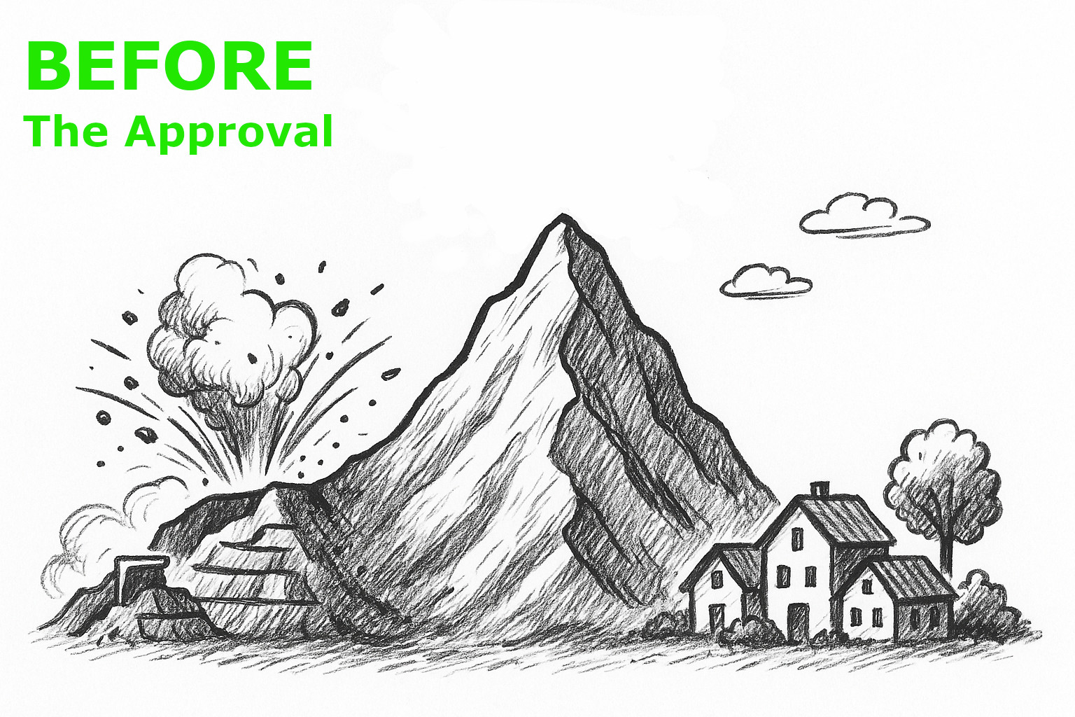
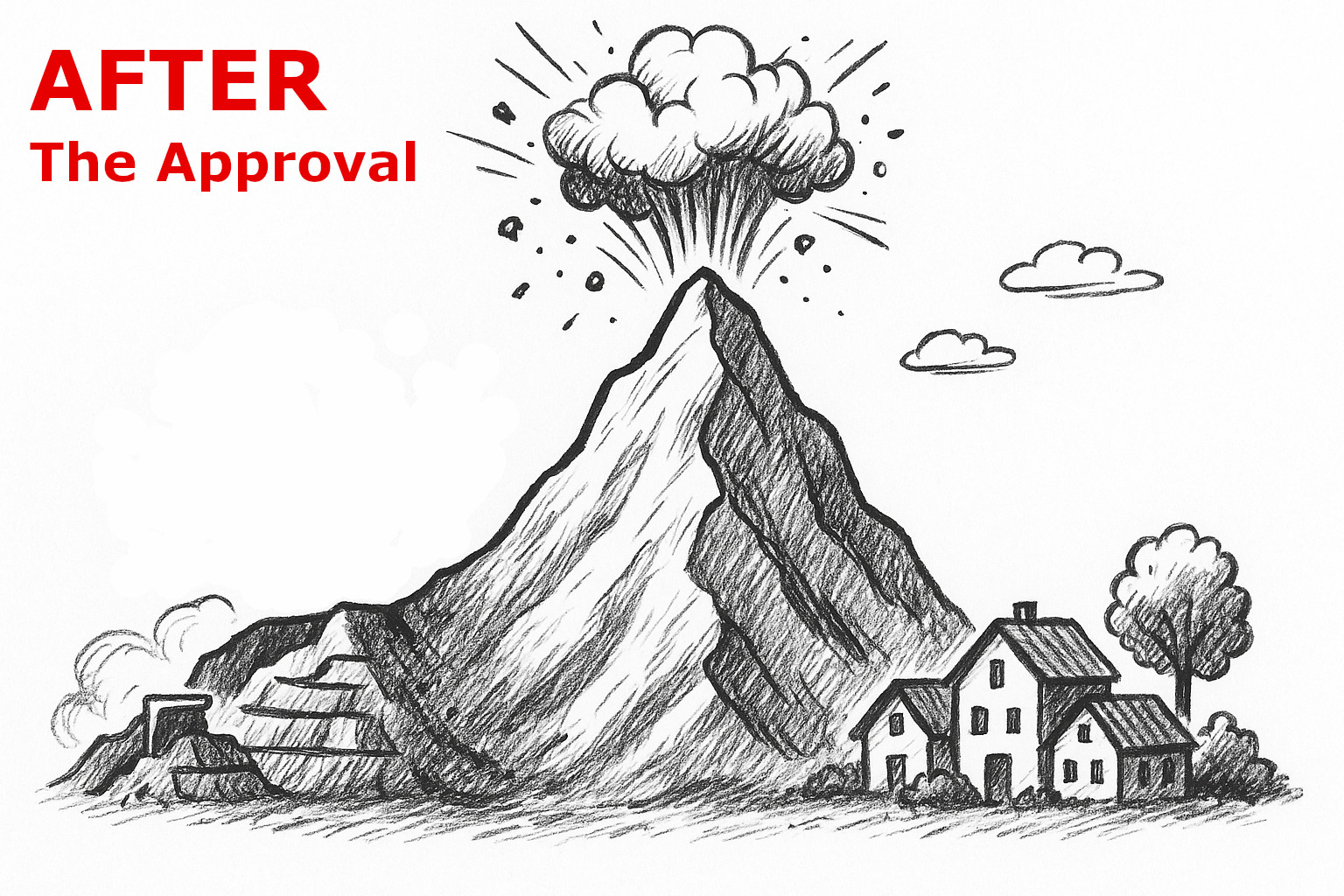
In 2024 the quarry jumped to the top of that mountain ridge. Now the nearest neighbours are living in a blast zone, subject to constant industrial noise, silica dust, and the risk of rolling rocks and landslides.
Elsewhere, hundreds of houses that were built around the visual amenity of world-leading rainforest are now facing the prospect of a quarry face, 500 metres wide, 250 metres high.
What about the public notification process?
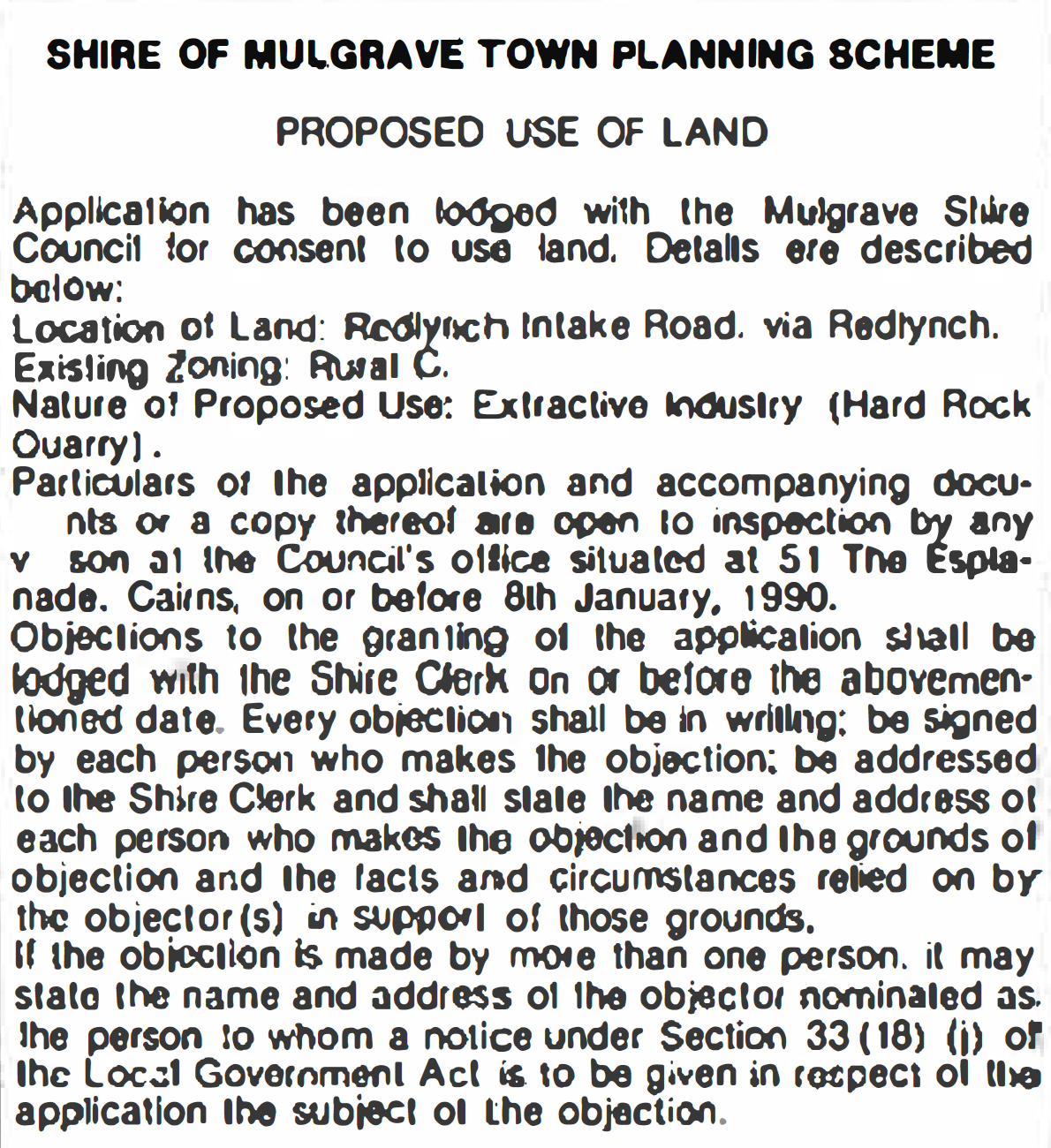 Public notice, Cairns Post, 23/12/1989
There was public notification for the initial consent in 1990. An advertisement was placed in the Cairns Post over Christmas/New Year. Objections were received. There has been no public notification since.
In 2014, while approving a major extension that climbs the mountain, Cairns Regional Council decided that public notification was not necessary because in its view, it would be unlikely to receive any objections. Residents strongly disagree.
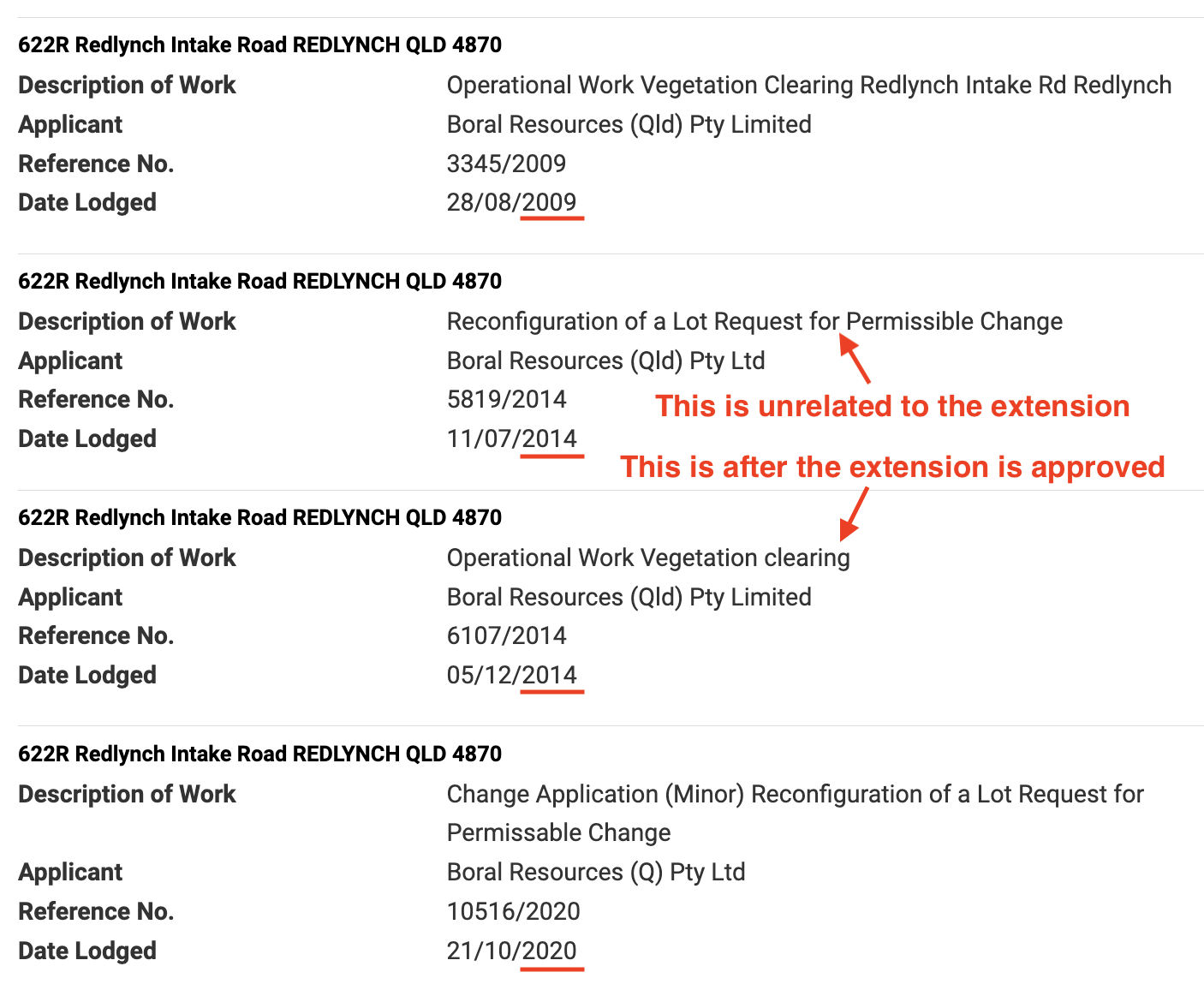
How was the extension approved?
The application to extend the quarry was handled as a minor change under the delegated authority of the Cairns Regional Council.
In our opinion it was not eligible to be handled as a minor change. We believe it should have been handled as a major change where it would have been assessed much more thoroughly and held to a far higher standard. It would have been subject to public notification and consultation, a vote by elected Councillors in a public meeting, and the full scrutiny of State government departments.
The 2014 approval by CRC paved the way for subsequent vegetation clearing – including clearing of cassowary habitat – and navigating the federal government’s environmental legislation.
Does that mean the entire property can be quarried?
Who knows? From the commencement of the quarry there has been no approved map. Despite this, while approving the massive extension in 2014, Cairns Regional Council repeatedly claimed that “The proposed changes do not alter the boundary of the approved operations”.
Boral had proposed a map in 2001 but it was rejected by a vote of elected Councillors. In 2014, Boral put forward the same map however this time it was assessed ‘under delegation’ so there was no vote by elected Councillors. Council used an internal process to approve the application, including the maps that had been rejected more than ten years earlier.
Where did residents get their information?
The 2014 development application has never been published on the Cairns Regional Council portal.
 The CRC approval history demonstrates the missing 2014 application
Residents used Right to Information laws to uncover full details of the 2014 application including the Council’s justification of the approval. For completeness, we requested all details of the quarry’s approval, from it’s inception in 1990 to the current date.
What are residents’ main concerns?
Residents to the north of the quarry are struggling with industrial noise, silica dust, and the fear of rolling rocks and landslides. Residents to the south have a direct line of sight to the rainforest mountain and will eventually be looking on to a quarry face 500 metres wide, 250 metres high.
 Residents have many concerns
The impact on the environment is difficult to calculate. It is adjacent to Wet Tropics World Heritage rainforest, and the area around the quarry is a well-known cassowary hotspot.
NIMBY’s eh? If not Redlynch, then where?
Cassowaries versus road base? Community versus road base? Quarries provide important products but ideally they would:
- not destroy pristine rainforest,
- not be located in cassowary hotspots,
- not bear down on houses only a few hundred metres away,
- not produce clouds of silica-dust alongside residential areas,
- not destroy the visual amenity of hundreds of residences, and
- not create a major eyesore alongside Wet Tropics World Heritage rainforest.
The resource quarried at Redlynch is highly available throughout north Queensland, particularly in the area from Gordonvale to Palm Cove, and west to the Atherton Tablelands.
What does Cairns Regional Council say?
CRC have advised a number of residents that the quarry is operating lawfully and that it considers the matter closed. It will not field further questions on this matter, except where ‘new information’ is available.
What about other government agencies?
Residents have consistently received the message that once such a development has been approved it is hard to roll back. Nevertheless, we continue to work with all regulators and politicians as and where we can.
So far we have engaged in depth with Cairns Regional Council (CRC), Queensland’s Department of Environment, Tourism, Science and Innovation (DETSI), Australia’s Department of Climate Change, Energy, the Environment and Water (DCCEEW), Queensland’s Crime and Corruption Commission (CCC), State MP’s, Federal Senators, and other, more specialised authorities.
What role does World Heritage play?
The quarry is adjacent to Wet Tropics World Heritage. The extension of the quarry diminishes the visual amenity values of that area. It also destroys cassowary habitat, and the last safe corridor for cassowaries traveling north/south along the valley.
Australia has a legal and moral obligation to UNESCO to protect the outstanding universal values of the Wet Tropics World Heritage rainforest, and the endangered cassowary.
Residents are exploring options with UNESCO.